
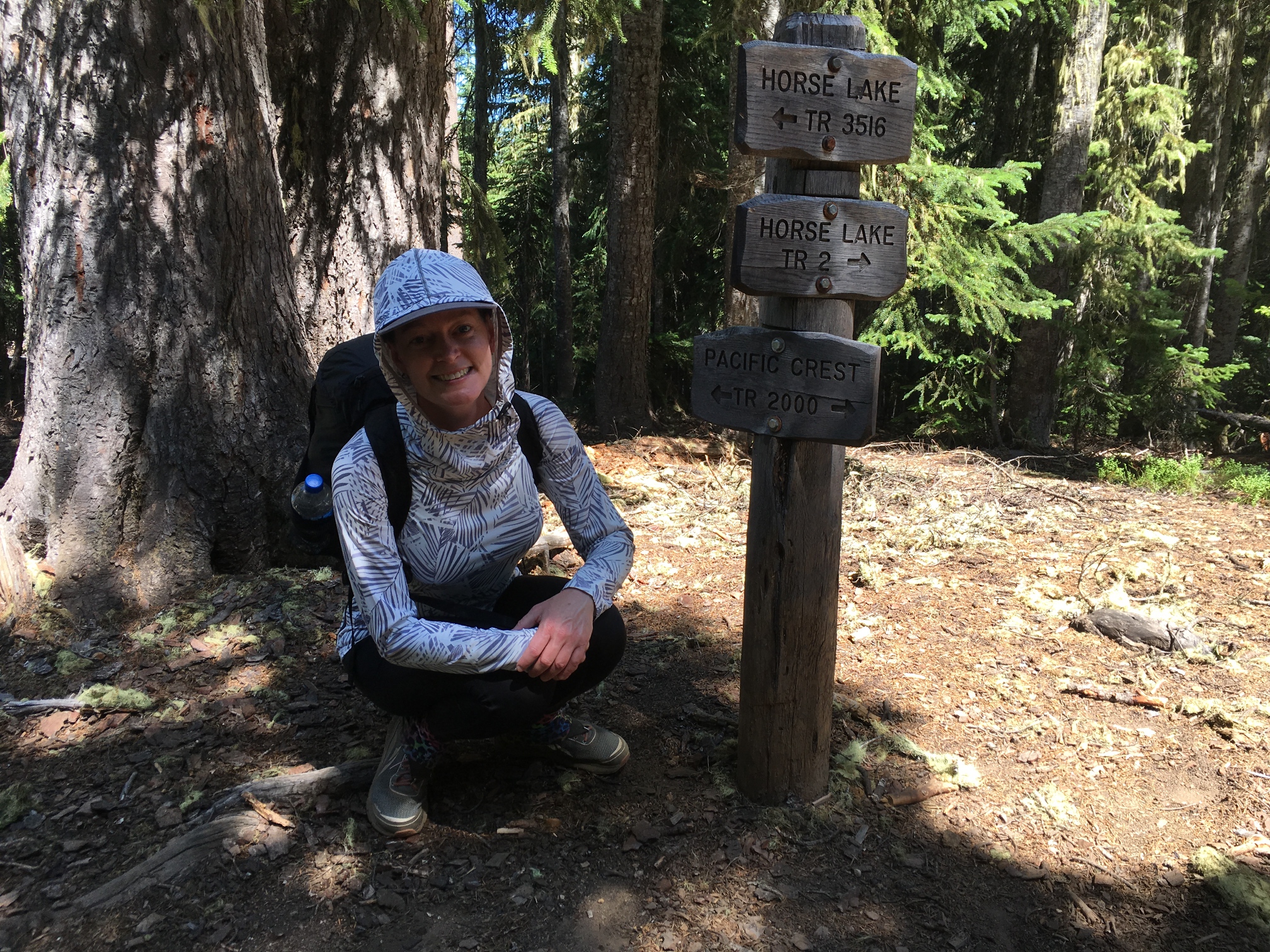
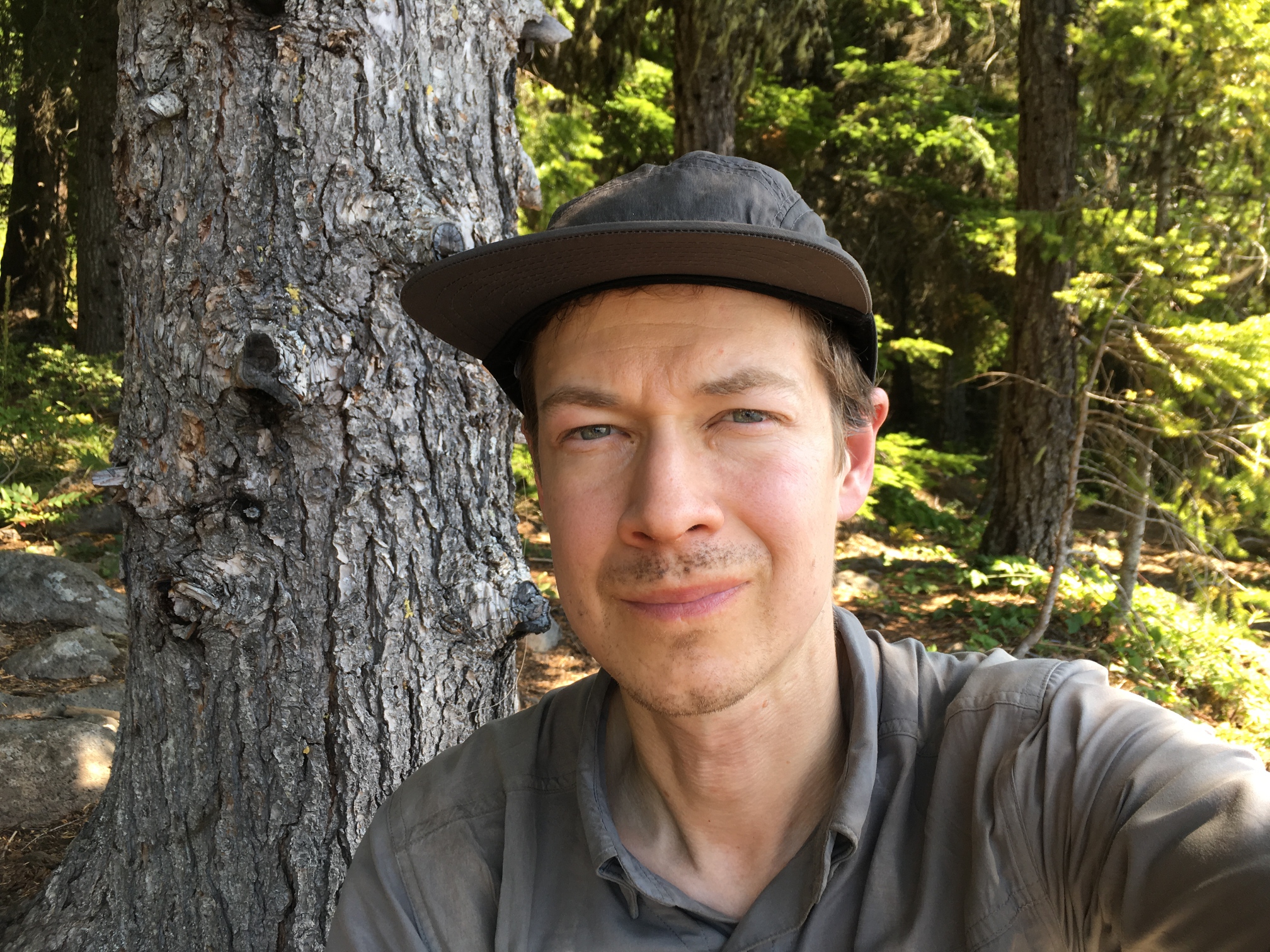
Oregon PCT Section: Elk Lake to Timberline Lodge
In the Fall of 2018 I asked Angie if she would be willing to go on a long backpacking trip. We've done overnighters together, but I wanted to see what a relatively long trip would be like. Surprisingly, she was interested in trying it, so I spent the winter trying to figure out what section of the Oregon PCT we could do. The plan was to be out for 10 days; that's 3 days more than I've ever been out for but 10x more than Angie! I estimated 15 miles of hiking per day to be conservative but was hopeful we'd be able to get in a little more than that if things went well. So I needed to find a 150 mile section. Timberline felt like the obvious place to end a hike as we could catch a bus back to Portland and ending there would kinda feel like walking back home from wherever we started. 150 miles south happened to be the perfect place to start a hike too. It put us just west of Mt. Bachelor and south of Three Sisters Wilderness which is one of the prettier sections of the whole PCT. So it was settled. We would start at the Elk Lake trailhead west of Bend and walk back home to Mt. Hood. Our start date was Monday July 29th 2019.
Day -1: This was the big anxiety day. This always happens before a big trip and it's good for me to actively remember it. I could barely eat dinner my stomach was so upset and I couldn't even think straight by 8pm. We went to see Once Upon a Time in Hollywood after dinner which was probably a good distraction.
Day 0: I slept well last night and today feels better. I also realized I was using 2-year expired anchovy paste in my salad dressing the past few nights - this may explain a bit of the stomach pain. I've got a long todo list I need to work through today which is good for keeping my mind occupied. I wish I could just flip a switch and be unconscious as soon as I'm done with the list, but I imagine there will be some point later in the evening when I'm mentally done but it's not time to sleep yet.
Day 1 - mile 1952.6 to 1964.0 (11.4mi): We drive from Portland to Elk Lake and start hiking at 2pm. I'm still a bit nervous on the drive and at the trailhead but feel better when we finally start walking. The beginning is dusty yet strangely mosquito-y. I wasn't expecting so many mosquitos in such dryness. Angie puts on rain pants to keep them from biting her legs and rain pants are not comfortable in Oregon in late July. We both quickly don our mosquito headnets too. An hour or so later I realize my headnet has blown away after I raised it above the bill of my hat for a mosquito-less stretch. I backtrack and look all over for it for probably 45 minutes, but it's a windy day and it's long gone. Day 1: lost mosquito protection in Oregon in July. I feel bad about this for numerous reasons.
When we get to camp it takes us forever to setup. I guess we're pretty new at this. The mosquito onslaught doesn't help as it highlights every delay or mistake we make. By 9:45 we're finally in bed.
![]()
-
![]()
Headnet, rainpants
-
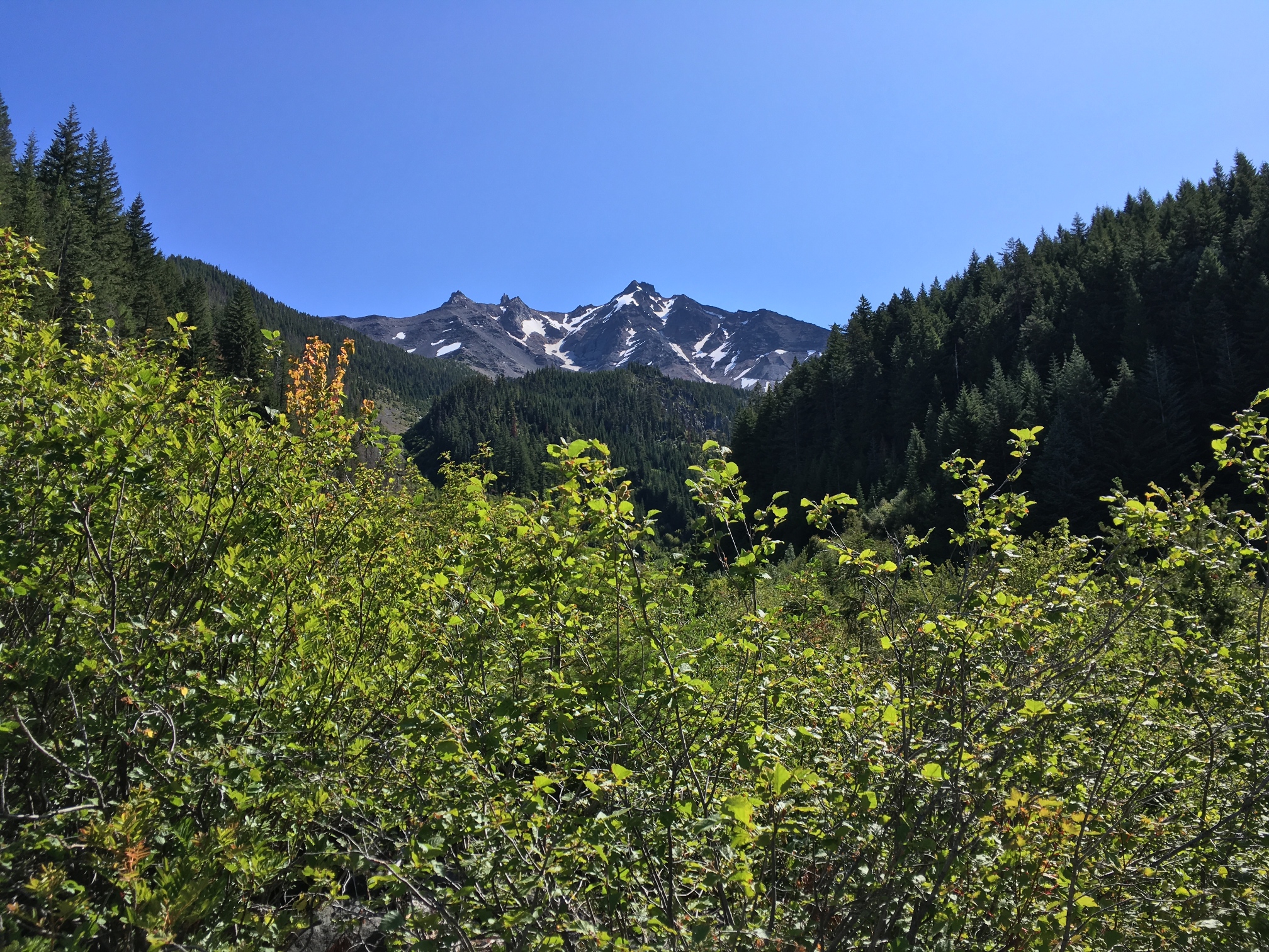
![]()
Entering Three Sisters Wilderness. That's South Sister in the foreground and Middle Sister poking up in the background.


Day 2 - mile 1964.0 to 1979.8 (15.8mi): Slow start this morning. We wake up at 6am but don't start hiking until 8am. We camped next to Pineapples who is the first thruhiker we meet on trail. She's flipped up from California to avoid the snow in the Sierra until it melts more. This is what a lot of thruhikers are doing this year and there's a lot of them in Oregon right now as a result, which is fun.
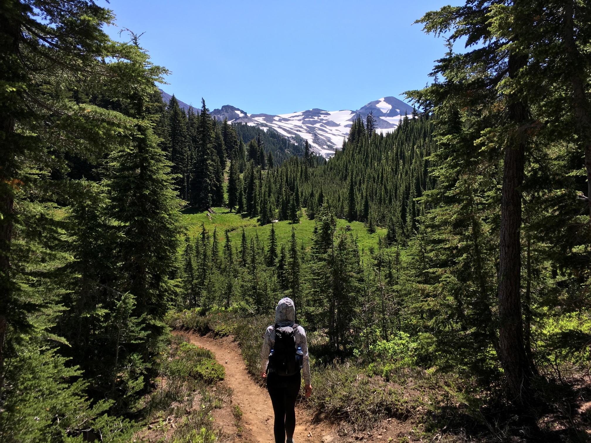
Pretty quickly we get into the heart of the Three Sisters Wilderness. We walk onto the lava flows and across the wild Lord of the Rings looking scenery of central Oregon. After cresting a small lava pass the mosquitos seem to diminish a bit and we hit Middle and North Sister which are some of the most dramatic parts of the Oregon PCT.
We get to camp early (around 4pm) because there's a 14 mile waterless stretch after the lake we're staying at (South Matthieu). We'll take on that stretch from a freshly hydrated perspective tomorrow. We rinse our shirts and socks in the lake and then get a great sunset view from our camp.
-
![]()
Middle Sister
![]()
![]()
![]()
-
![]()
Walking on the lava flows. North Sister in the background.
![]()
![]()
-
![]()
Angie Gumbys down some snow.
-
![]()
North Sister behind us from camp on day 2.
-
![]()
Sunset on day 2. Ahead of us from the center to right: Mt. Washington, Three Fingered Jack and Mt. Jefferson.


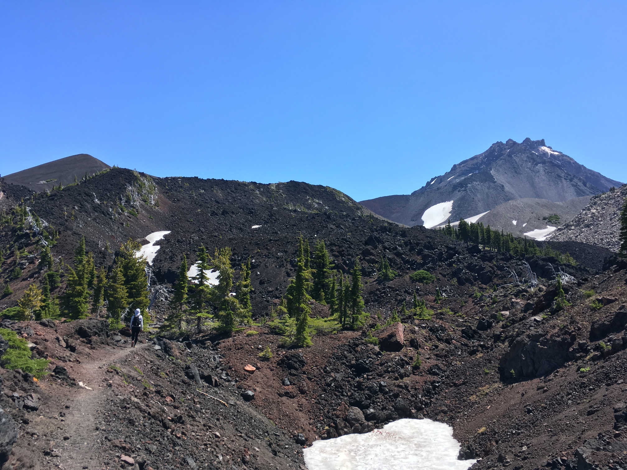
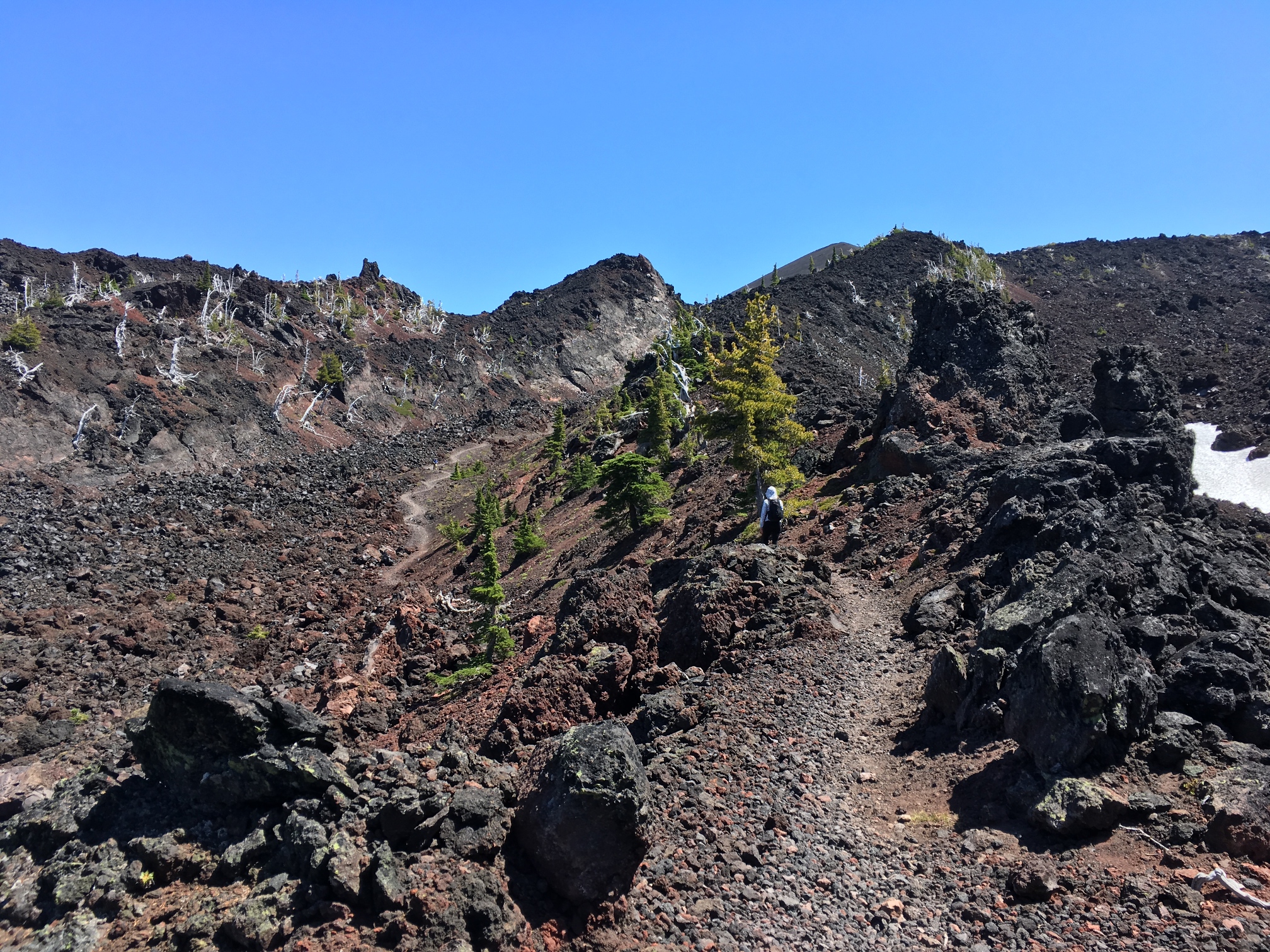
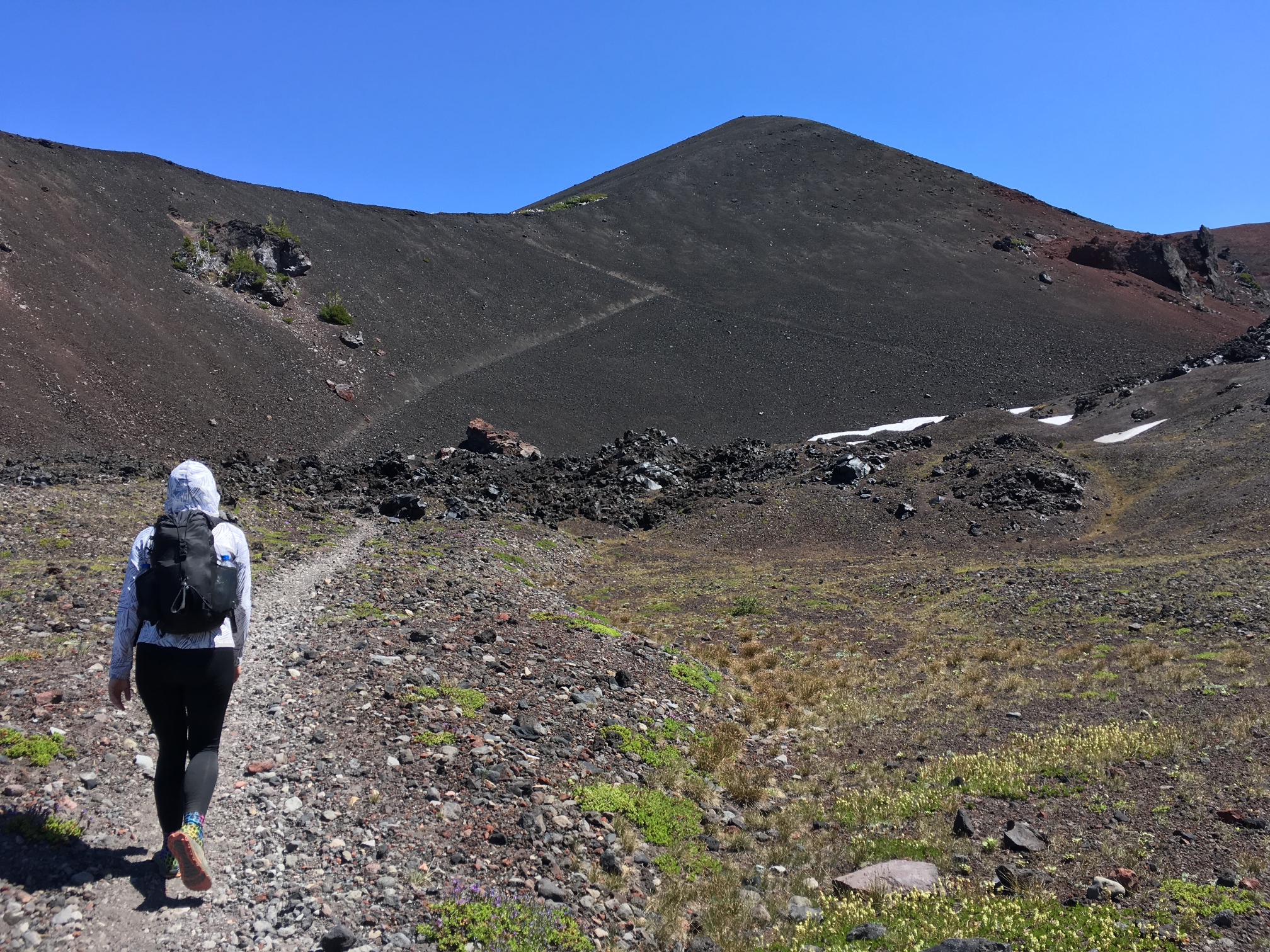

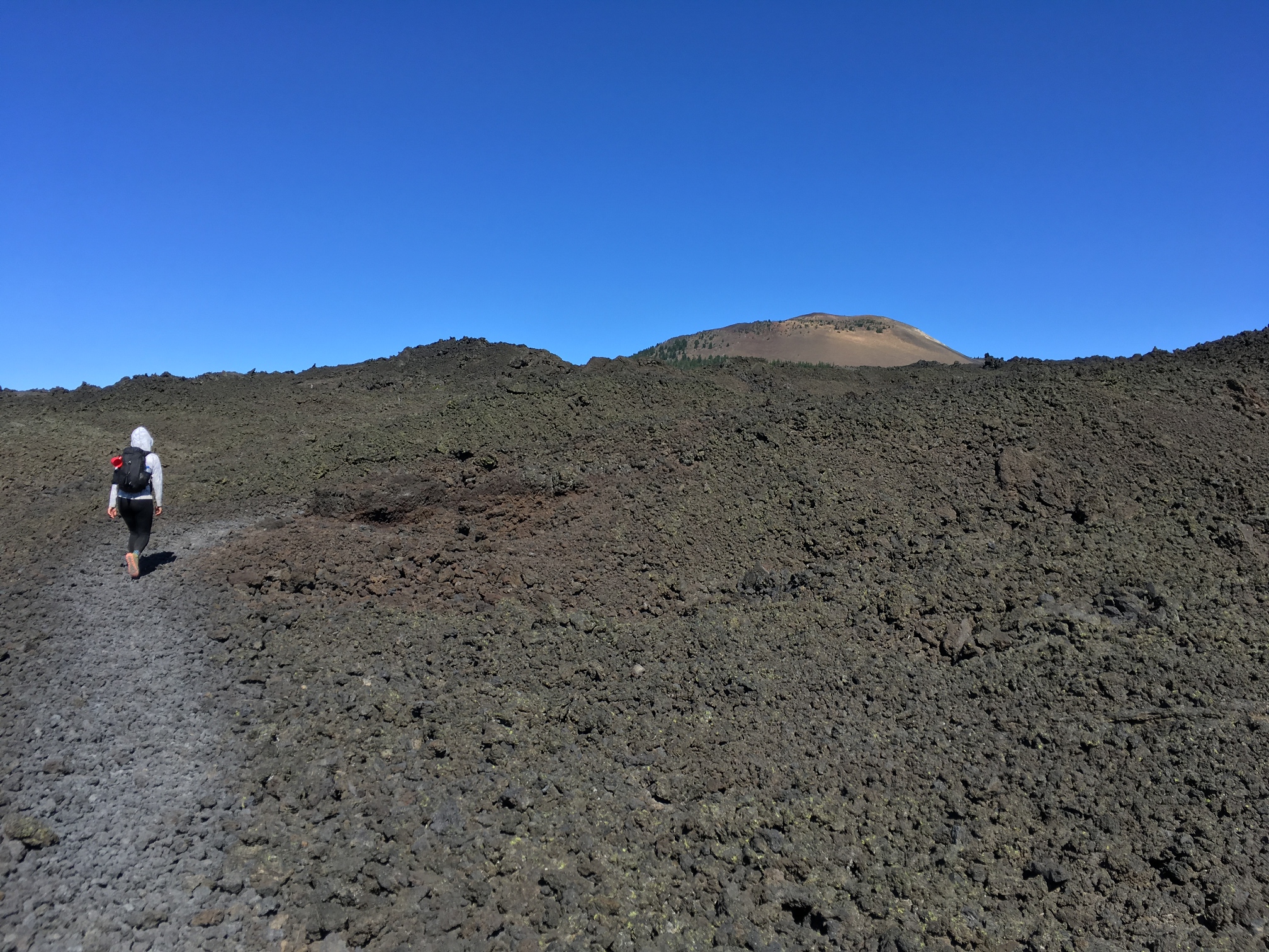
Day 3 - mile 1979.8 to 1998.9 (19.1mi): Today begins with 4 miles of lava field walking as the start of the 14 mile waterless stretch. My pack is heavy from the extra water I'm carrying and the lava, while quite interesting to look at from a distance, really requires a lot of head down close attention hiking. It's a lot of medium-sized rock piles that move under you as you walk. It's still a trail, but it's almost like walking over small talus.
Right after the lava we tend to our feet a bit as the rough trail has done a little damage blister-wise. Then it's another 10-12 dry miles around Mt. Washington through old burns to Big Lake Youth Camp for our resupply. Big Lake is a friendly place. They provide free dinner for hikers and accept resupply packages if you want to send yourself food and supplies. We sort through our resupply and realize that we're moving faster than expected already and will not need all this food. We donate some to Pineapples and the other hikers who are there. We think of staying for dinner, but we've only been hiking for a couple days and don't need the break yet so we press on to make camp at a small lake about 3 miles further on where Two Pound is camped as well. We only say hello to him briefly, but we'll run into him again. At 4am we hear weird mechanical noises in the distance and eventually realize that we're camped not far from a logging operation of some sort. It felt like wilderness until those saws started up.
-
![]()
Camp in the morning looking back towards North Sister again.
-
![]()
The lava rocks section.
-
![]()
Mt. Washington
Day 4 - mile 1998.9 to 2018.8 (19.9mi): We get started a bit quicker today due in part to the urgency of aggressive mosquitos. Angie is also getting good at camp chores, so we can get stuff done almost twice as fast now.
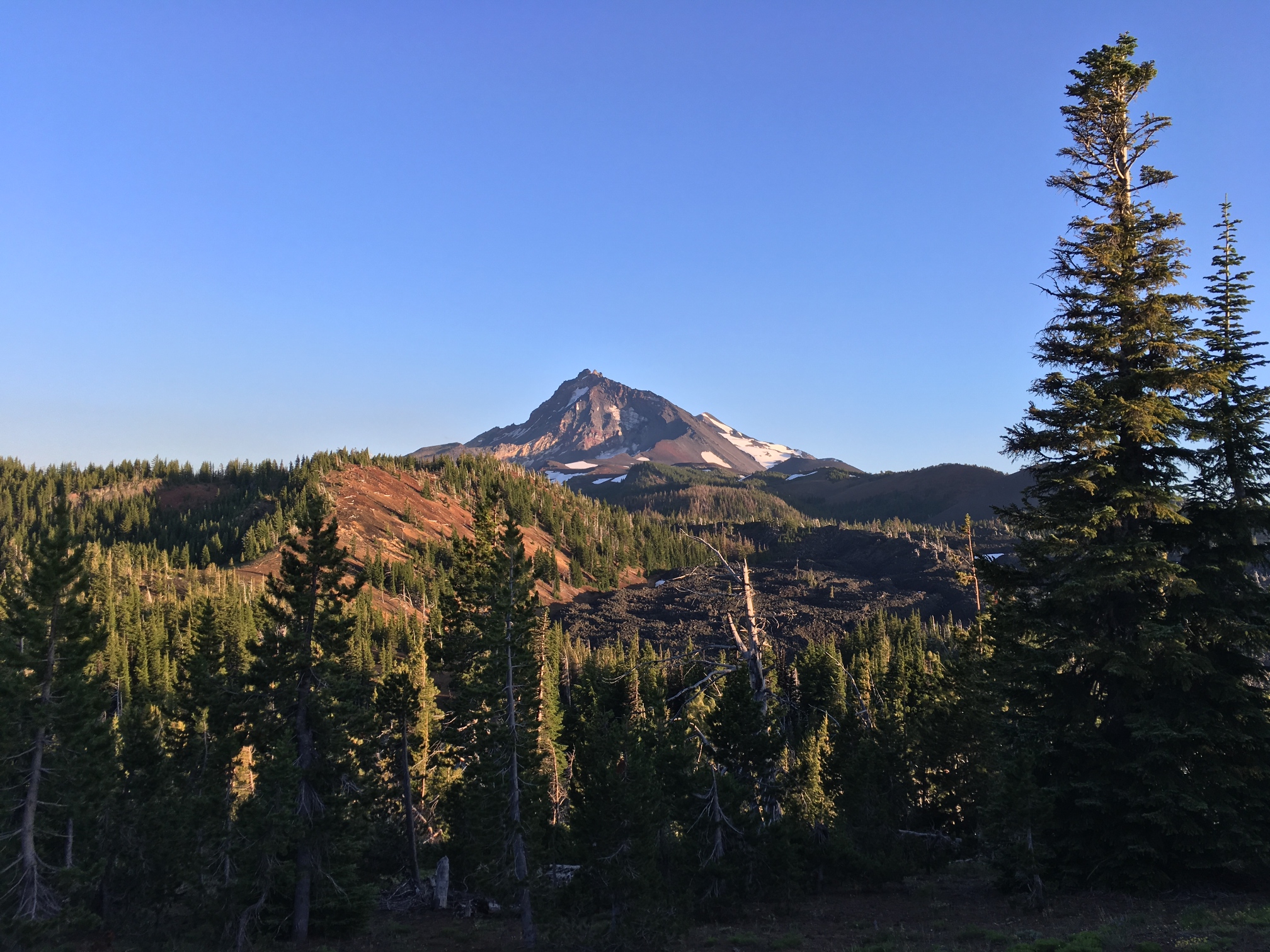
We walk around Three Fingered Jack first which is quite dramatic on the north side. We're still walking through burn zones, but they are a older and less depressing than the ones we saw yesterday. We enter Mt Jefferson wilderness and take a long lunch and foot care break at a breezy lake with no mosquitos. After our break on our last climb of the day we bump into Karl the German! We gave Karl a ride to a PCT trailhead on our drive out of Portland. He was heading south from Mt. Hood and we would be heading north from Three Sisters, so we knew we'd probably run into him at some point. And then we did!
We hike on to an exposed camp with a great view of Mt. Jefferson but the mosquitos are terrible despite being on a windy ridge. We try to make dinner in the windiest spot we can find (which is not the usual strategy), but even then the mosquitos destroy us. A SOBO (South Bound) hiker later asked me how the mosquitos were in Oregon and when I said they were bad he doubted my assesment given his experience in Washington where he thought they were terrible. I said it was a "you slap your knee and kill 6" situation and he groaned and understood immediately that they were indeed still quite bad in Oregon. This is the place I was describing with that assessment.
-
![]()
South side of Three Fingered Jack.
-
![]()
North side of Three Fingered Jack.
![]()


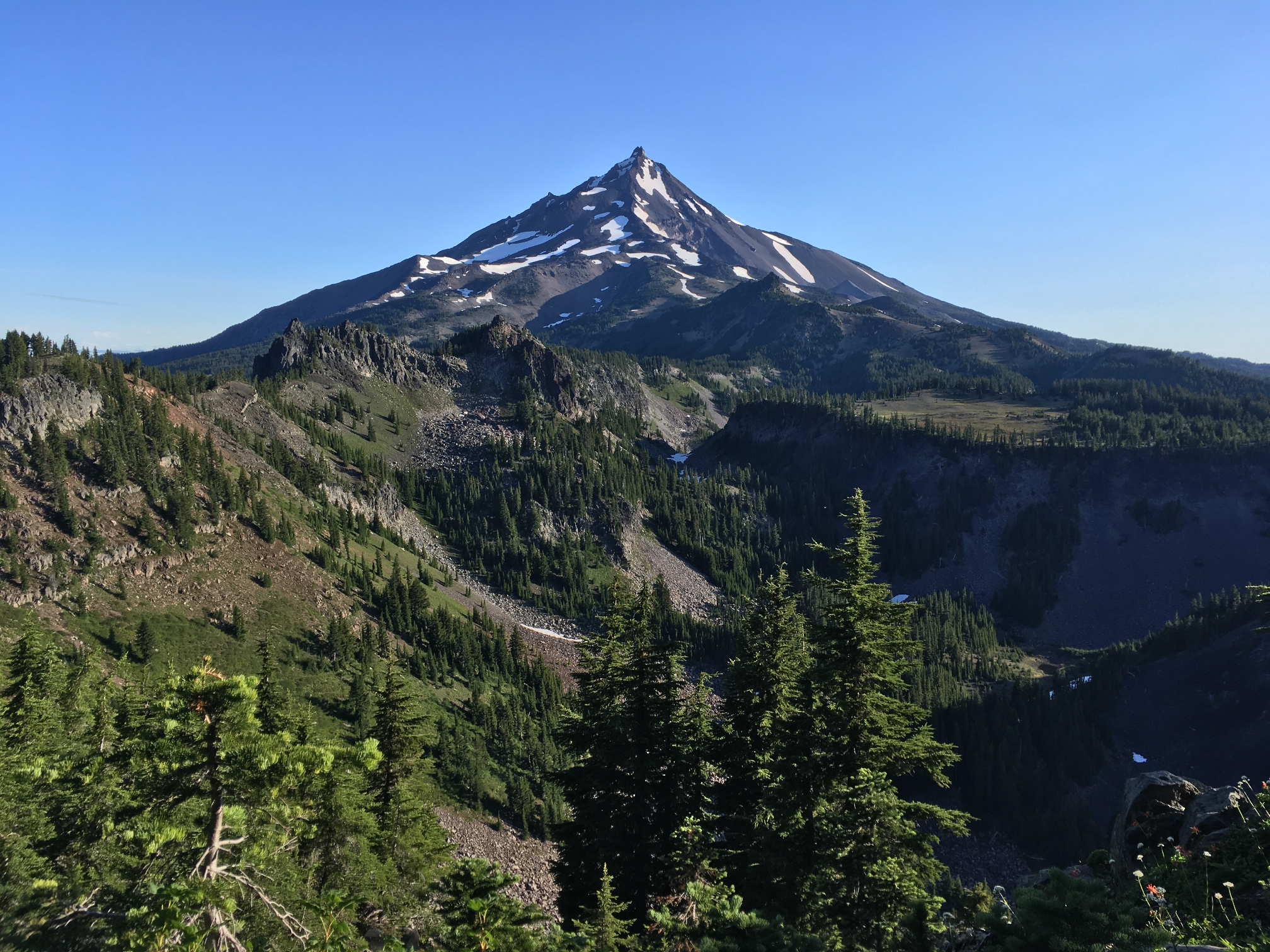
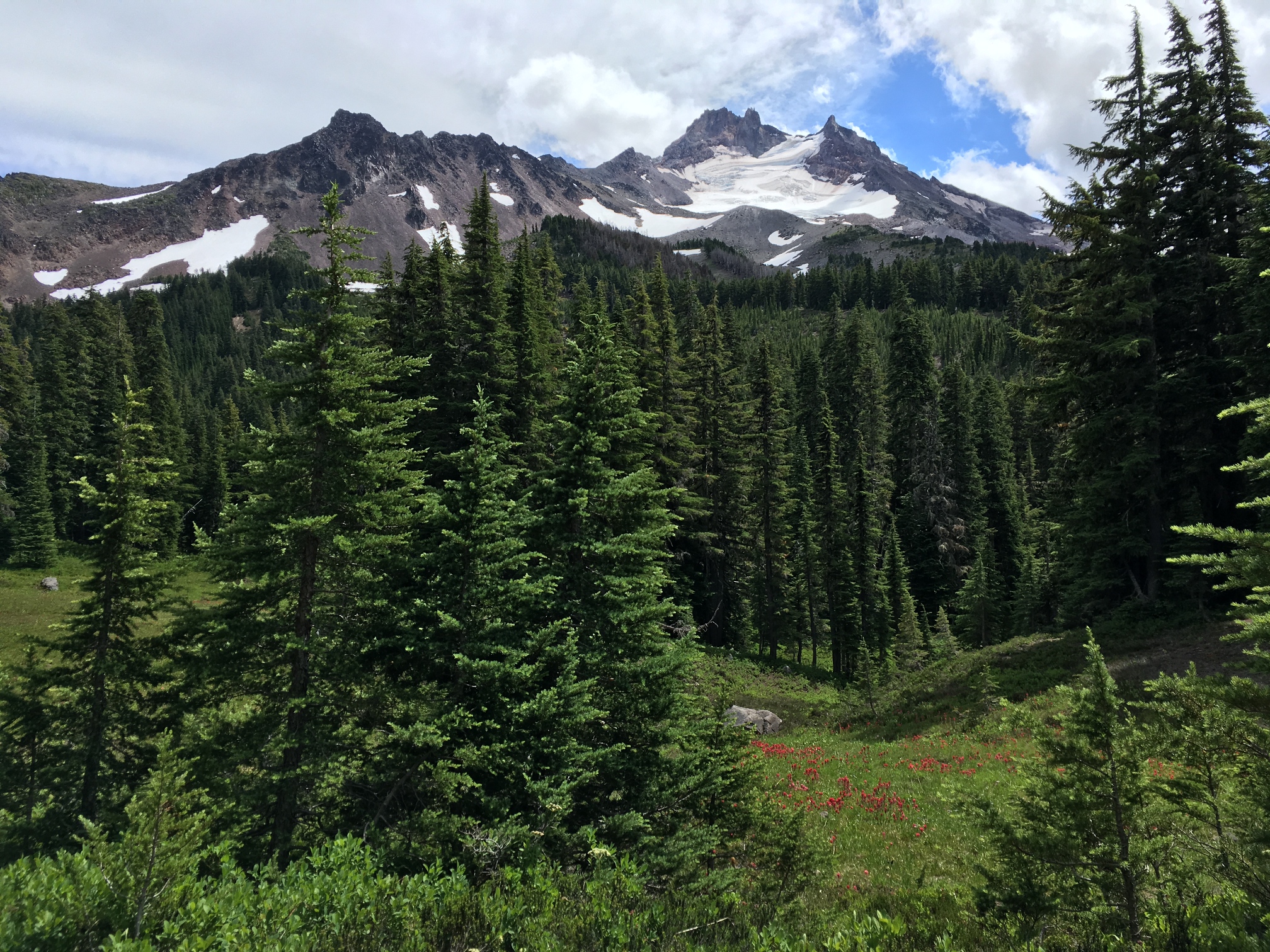
Day 5 - mile 2018.8 to 2040.7 (21.9mi): We set the alarm for 5:30 and we're walking by 7:00. The first goal is to get past two water crossings (Milk Creek and Russell Creek) that can sometimes be dangerous in the afternoon. Both creeks are fed by snowmelt from Mt. Jefferson and the flow increases later in the day when it warms up. We cruise all morning and make the 12.5 miles we need to get over both just before noon. We rock hop across both, so our feet never even get wet. As soon as we get to the other side of we take a long break to dry our sleeping bags, eat and do a little foot care.
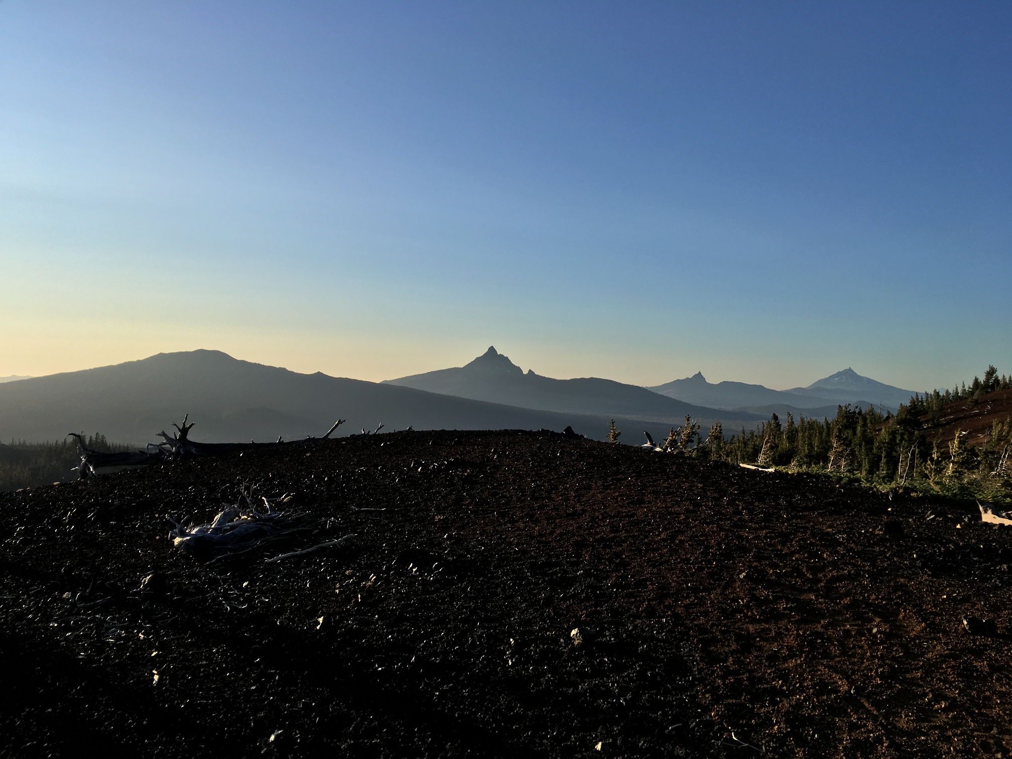
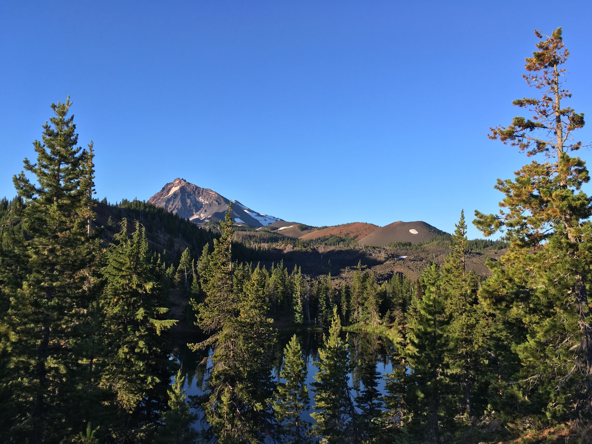
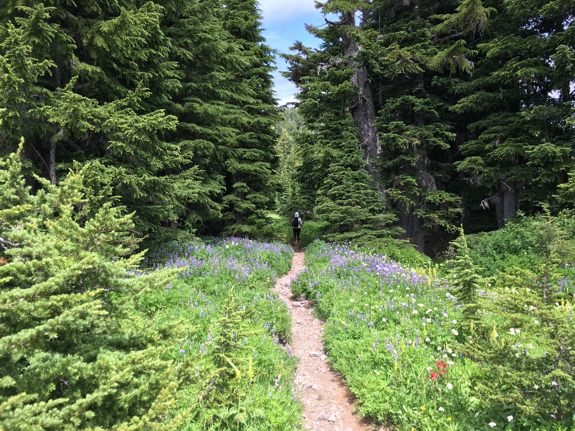
When we get started again we realize we don't have to worry about water anymore. It's everywhere now. We've enter Jefferson Park which is the most popular part of the Mt. Jefferson wilderness for good reason. It's all flowerful meadows and big trees and great views of the peak that it gets its name from. My favorite part though is exiting the Park. There's a long beautuful walk up a ridge to Park Butte where there's a great view of everywhere we've been today and everywhere we'll be in the days ahead. There's snow and rock and big Oregon clouds all mixed into a really beautiful alpine scene.
At the pass after Park Butte we enter Mt. Hood wilderness. Since I frequently day hike in the Mt. Hood wilderness I suddenly feel very close to home now. We're not; Mt. Hood is just a really big wilderness area. We walk down from the pass for another couple of hours and finally make it to a camp by a pond just past Brietenbush Lake. There are barely any mosquitos here somehow. I don't question it.
-
![]()
The classic Jefferson view from the south.
-
![]()
Mt. Jefferson somewhere between Milk and Russell creek.
-
![]()
Starting to come around the north side of the mountain. That's a big glacier.
![]()
-
![]()
On the climb up to Park Butte.
-
![]()
Over the pass and into Mt. Hood Wilderness.


Day 6 - mile 2040.7 to 2063.0 (22.3mi): We walk about 5 miles from camp to Ollalie Lake for a partial resupply at their hiker friendly general store. I'm expecting a crap selection, but they've got everything you could want and we get a great pile of food here. They have mac & cheese, tuna, crackers, chips, bars, oreos and more. And we see all the hikers we knew there plus meet a few others. Some are heading north, some south. Everyone was in a talkative mood. It was an unexpected highlight and a morale boost given Angie's blisters were getting her down.
After we leave we pass Two Pound who is sitting on a tree stump drinking the beer he got from Ollalie and watching Netflix. His ankle was bothering him so he thought this was the best remedy. The rest of the day was pretty easy trail through the trees and we keep a steady pace but take a longish afternoon break so that Angie can tape her feet and nap. We finally make it to camp at about 7pm where a small group of southbounders generously make a little room for us.
-
![]()
Looking back at Jefferson from on the morning of day 6.
![]()
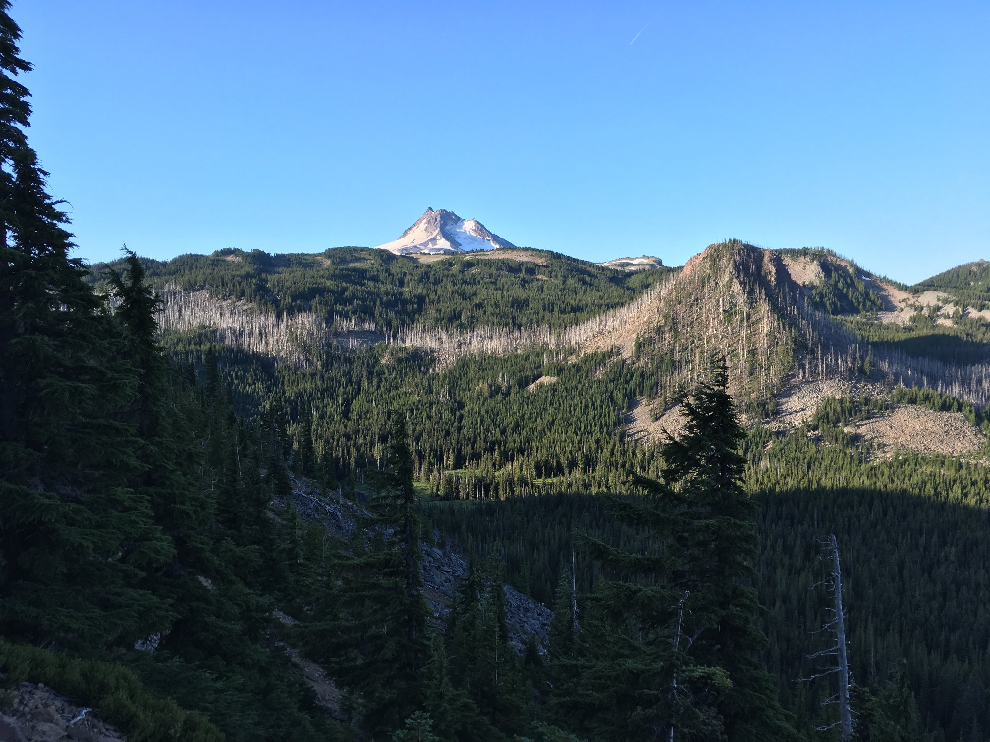

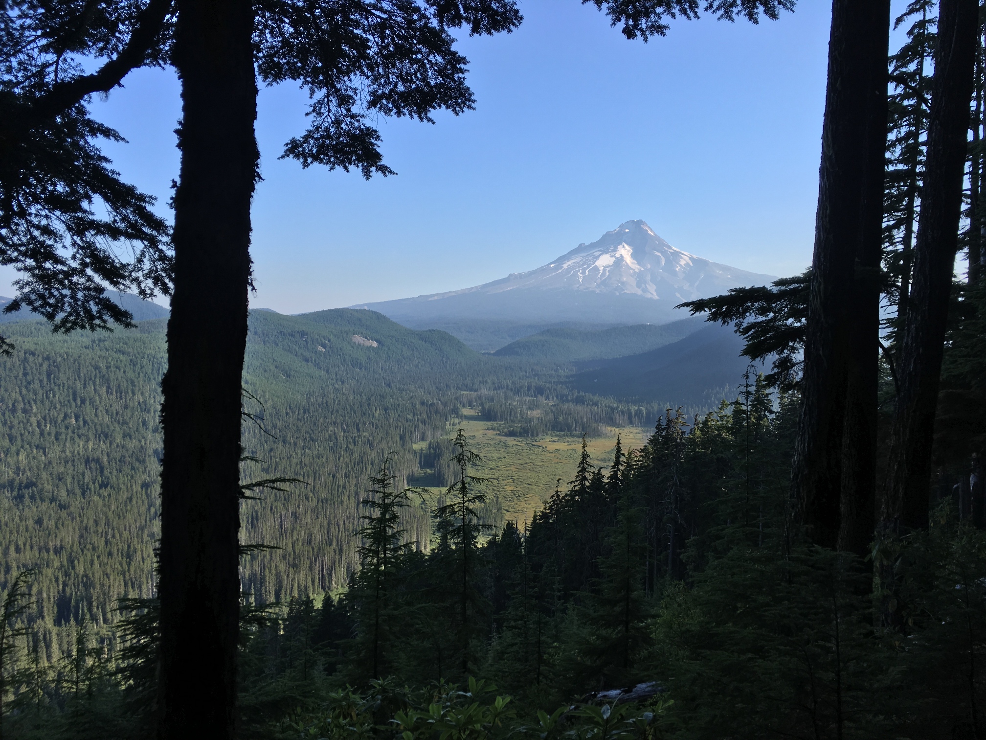
Day 7 - mile 2063.0 to 2083.2 (20.2mi): We walk onto trails I've dayhiked from Portland today. We're getting close. There aren't many views of Mt. Hood yet though as we've been in thick forests for most of the past two days. I'm not complaining given the burns we've had to walk through lately. Forests are beautiful.
Angie's feet are not beautiful, but she's established an amazing foot maintenance routine with leuko tape and bandaids that seems to do the trick. We take a long break mid-day at Timothy Lake after we finally find a spot to rest this crowded weekend day where she completes this routine again.
We're camped 14.2 miles out from Timberline tonight. We should finish our hike tomorrow in the early afternoon.
-
![]()
Tired, dirty, serious.
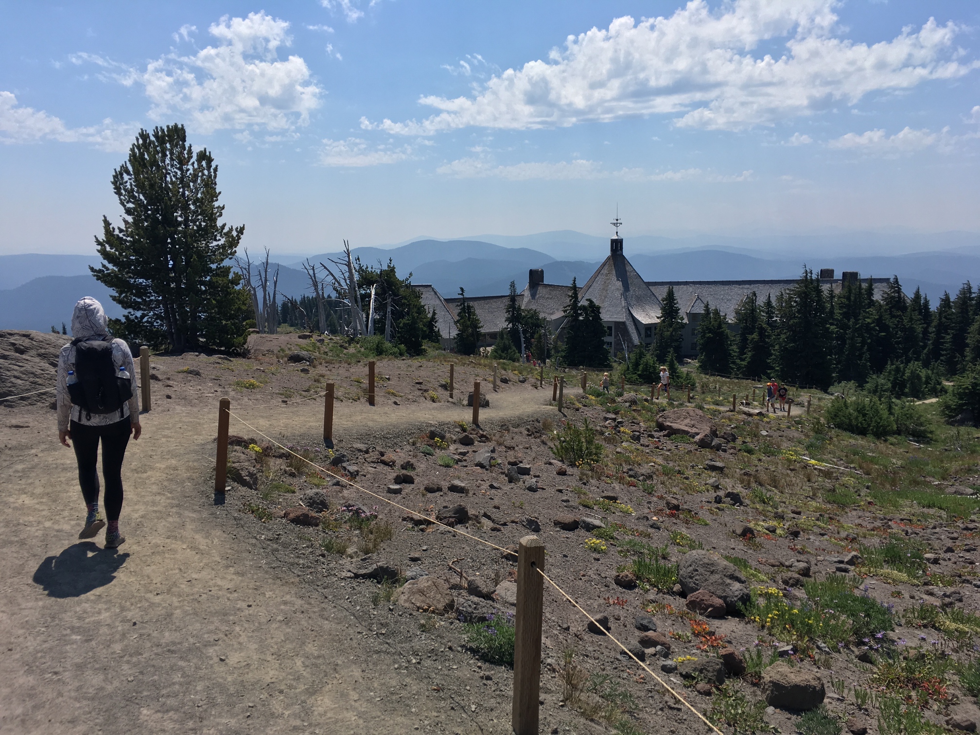
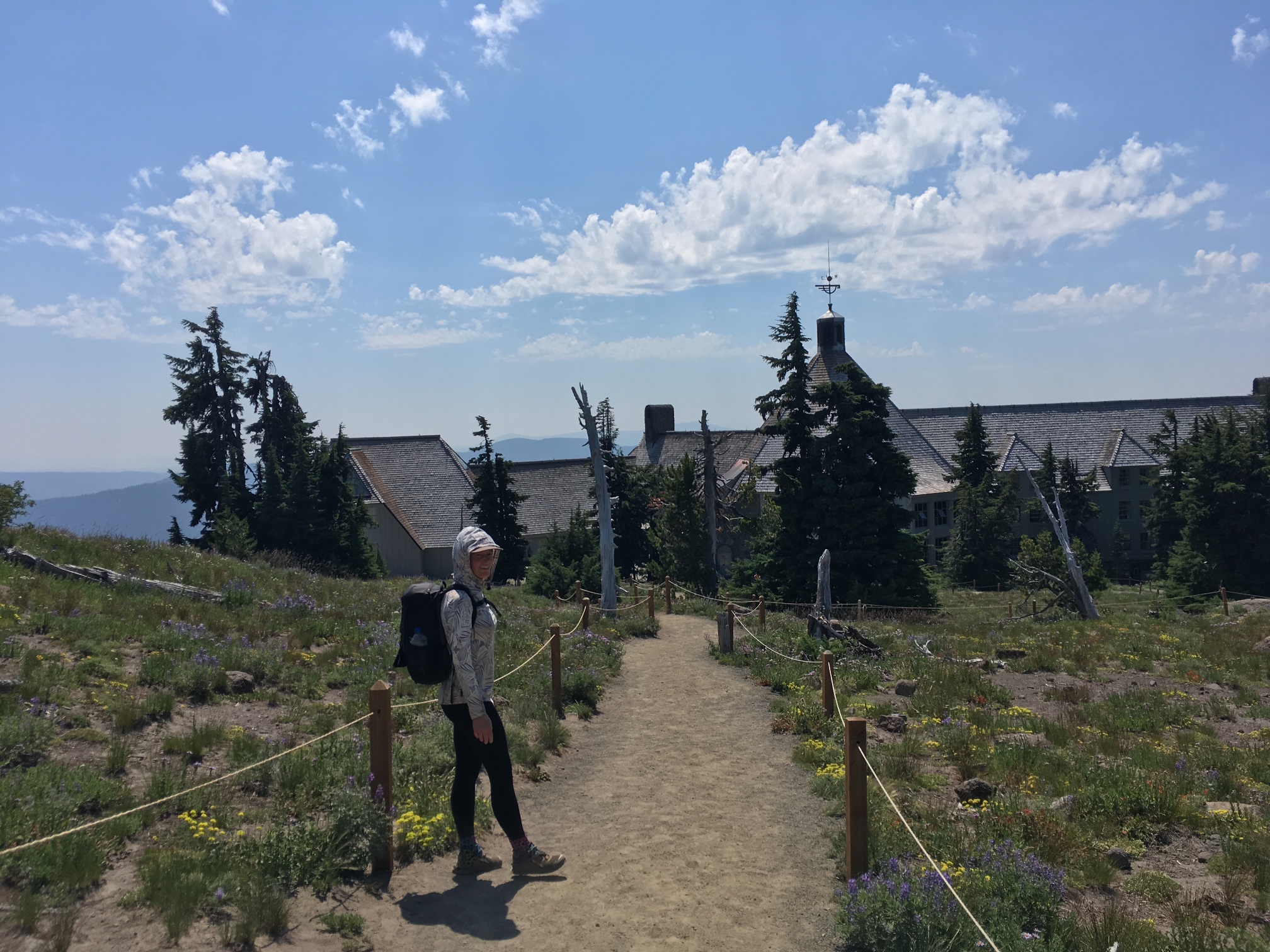
Day 8 - mile 2083.2 to 2097.4 (14.2mi): Last day on trail. We wake up at 5:45 and were walking by 6:45. There's still plenty of room for improvement, but we're getting much better about getting out of camp quickly in the morning. We only have 14 miles to Timberline and there's pizza and beer waiting for us there. We leave camp with full water (2L for me and 1.6L for Angie) as the next source is 12 miles away. It gives us enough to make cold coffee on the go and still stay hydrated.
We start to see views of Hood quickly once we get started. We're mostly in the trees, but the mountain peaks out as us regularly now. Of all the mountains on this hike, Hood stays hidden the longest it seems. Then we're over Hwy 26 and on the final ascent to Timberline. Towards the end there's a short, open section just before the lodge that's pure sand. It's hot and steep and reminds me of hiking on an inclined beach without an ocean, but we're laughing the whole stretch because we're so excited that we're actually going to finish this trip that we've been anticipating for so long.
We get to Timberline and join the other smiling and smelling hikers there for some awesome patio time with delicious food and views all around us. We give away the rest of the food in our food bag to a group of friendly SOBOs who are 500 miles in and still downright giddy to be hiking the PCT. It's a great way to finish the trail. We hop on a bus to a bus to a Lyft and were back in Portland.


Map & Mileage Recap
- Day 1: 11.4mi
- Day 2: 15.8mi
- Day 3: 19.1mi
- Day 4: 19.9mi
- Day 5: 21.9mi
- Day 6: 22.3mi
- Day 7: 20.2mi
- Day 8: 14.2mi
- Total Trip Mileage: 144.8 miles
- Average daily mileage: 20.7 miles/day
We started hiking at 2pm on our first day and finished before 2pm on our last day so we were out for just under 7 days technically. Our 10 day plan was pretty conservative I guess. You can see our starting and ending points on this overview map from Halfmile. Elk Lake is at mile 1952.6 and Timberline is mile 2097.

Gear
I started with a 13.59lb base weight and 26.12lb total pack weight carrying 1L of water and 3ish days of food for 2 people. I carried the kitchen, tent and food for both of us. Angie carried a 22L pack with all of her gear that probably weighed 10 or 11lbs with water and snacks. She's getting a proper backpack this winter. [Lighterpack]
What worked
- Gossamer Gear Thinlight: It doubles as a backpad for my backpack and a comfort layer for use under my inflatable sleeping pad - all for zero added weight since it replaces a backpad that weighs the same but doesn't do double duty. This is probably my favorite gear purchase this year.
- Two coffees per day: It's the way to go. One when you start hiking and one about 4-5 hours later.
What didn't work
- Angie's blisters: I probably helped cause these as I suggested some thin socks that were a little too tight. Since she got blisters between her toes it's pretty likely that the new socks were part of the problem. Time for Injinjis. Relatedly, bring more leuko tape.
- My blisters: They were minimal and nothing in comparison to Angie's, but they weren't non-existent. I'm going to try Injinji liner socks to see if I can get down to zero blisters.
- Sock holes: I don't know what happened here. All of the sudden I'm getting holes in my Darn Tough socks above the nail of my big toe. That's never happened before. I used a new pair of my goto shoes, so maybe this particular pair just has some defect that's causing abrasion? I put some Tenacious tape in my shoe above where the holes are when I got home and haven't had any problems since. We'll see if that solve things.
- Mosquitos: I underestimated them (and lost my headnet). My shirt and Angie's tights especially were too thin to prevent bites.
- Too much food: I was a little too conservative on the food planning. We could have carried less since we were moving faster than expected. I think the daily amount was fine it was just that the estimate of days was off.
- Too much fuel: A 4oz canister would have been plenty as we stopped doing hot coffee in the mornings about half way in.
- My airpad leaked: I had to blow it up 2-3 times a night. It wasn't as terrible as it sounds, and I found the pinhole and patched it when I got home.
- Things I never used once: Long johns, sunglasses. I'd still bring both of them again though.
Final Thoughts
Most of the time I was planning this I thought it would either never happen or that we wouldn't finish the whole section. But we pulled it off and it was a really wonderful trip. It turns out that Angie really likes this style of backpacking. She was willing to try this whole thing and call it experiment, but she really got into it on trail. By the end of our hike she was encouraging us wake up at first light and efficiently making and breaking down camp to maximize our hiking day. And both of us really enjoyed being out with the thruhikers and being on the periphary of that community for a bit. Seeing the same folks from time to time day to day as everyone migrates from one place to another is inexplicably satisfying. It was also really satisfying to see all the beautiful parts of Oregon that were new to us and further explore the state we live in. Now we're both excited to figure out what section to hike next year.